|
Krabi is a southern province on Thailand's Andaman seaboard with perhaps the country's oldest history of continued settlement. After dating stone tools, ancient coloured pictures, beads, pottery and skeletal remains found in the province's many cliffs and caves, it is thought that Krabi has been home to homo sapiens since the period 25,000 - 35,000 B.C. In recorded times it was called the 'Ban Thai Samor', and was one of twelve towns that used, before people were widely literate, the monkey for their standard. At that time, c. 1200 A.D., Krabi was tributary to the Kingdom of Ligor, a city on the Kra Peninsula's east coast better known today as Nakhon Si Thammarat.
At the start of the Rattanakosin period, about 200 years ago, when the capital was finally settled at Bangkok, an elephant kraal was established in Krabi by order of Chao Phraya Nakorn (Noi), the governor of Nakhon Si Thammarat, which was by then a part of the Thai Kingdom. He sent his vizier, the Phra Palad, to oversee this task, which was to ensure a regular supply of elephants for the larger town. So followers many emigrated in the steps of the Phra Palad that soon Krabi had a large community in three different boroughs : Pakasai, Khlong Pon, and Pak Lao. In 1872, King Chulalongkorn graciously elevated these to town status, called Krabi, a word that preserves in its meaning the monkey symbolism of the old standard. The town's first governor was Luang Thep Sena, though it continued a while as a dependency of Nakhon Si Thammarat. This was changed in 1875, when Krabi was raised to a fourth-level town in the old system of Thai government. Administrators then reported directly to the central government in Bangkok, and Krabi's history as a unique entity separated from the other provinces, had begun.
|
Geography of Krabi
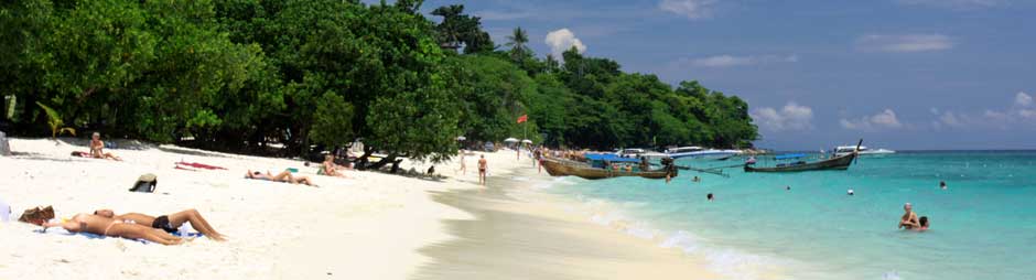
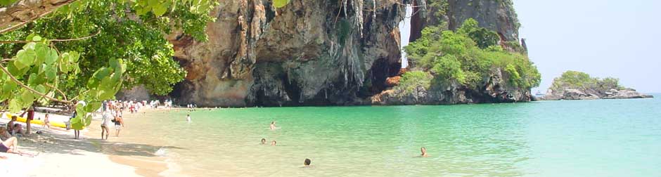
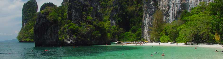
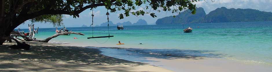
Krabi's mountainous physical geography is broken by highlands and plains on the mainland.The provincial administration also covers more than 130 islands in the Andaman Sea. Natural forest cover is chiefly mangrove and Cassia trees. Krabi's sandy clay soil conditions are perfect for a variety of agricultural products, including rubber trees, palms, mangos, coconuts, and coffee. The Krabi River flows 5 kilometers through the city and falls into the Andaman at Tambon Pak Nam. There are other streams as well : the Khlong Pakasai, the Khlong Krabi Yai and the Khlong Krabi Noi in the province's highest range of mountains, the Khao Phanom Bencha.
Krabi is administratively divided into 8 Amphoes (districts): Amphoe Muang,Khao Phanom, Khlong Thom, Plai Phraya, Ko Lanta, Ao Luk, Lam Thap, and Nuea Khlong.

Population
Krabi's estimated population, as of September 1999, is 344,610
|
Climate
Weather in Krabi is typically that of the tropical monsoon, providing the province with just two seasons, the hot season from January to April, and the rainy season from May to December. Monsoon winds, which change according to season, blow from the southeast, the southwest, and the northeast. Temperatures range between 16.9 and 37.3 degrees Celsius and the yearly rainfall averages 2,568.5 millimeters.
Travel around Krabi
To getting around the town is very convenient by local taxi (Tuk Tuk). Some attractions like Hat Noppharat Thara, Susan Hoi , Ao Nang, Wat Tham Suea, Namtok Huai To, and Ao Luk can be reached by local mini-bus (Song Thaeo). The mini-buses depart from Vogue Department Store on Maharat Road in Krabi Town. Trips to other attractions can be made by taxi and rental car.
|
|
Size, Location and Boundaries
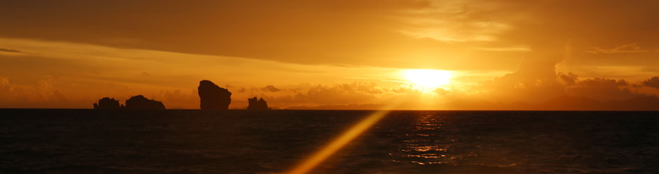
Krabi is on the Andaman Sea coast of south-west Thailand, between 7' 30" and 8' 30" north latitude, and 98' 30" and 99' 30" west longitude. Total area is 4,709 square kilometers bounded thus :
| North |
Connects with Phang-nga and Sura Thani Provinces. |
| South |
Connects with Trang Provinces and the Andaman Sea. |
| East |
Connects with Trang and Nakhon Si Thammarat Provinces. |
| West |
Connects with Phang-nga Provinces and the Andaman Sea. |
|